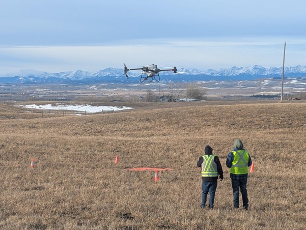
Starting November 4th, Transport Canada’s new Beyond Visual Line of Sight (BVLOS) rules will be opening the door to scalable drone operations in low-risk environments. Organizations operating in low-population-density areas and uncontrolled airspace are rethinking what’s possible in the skies. The new Level 1 Complex pilot certification and RPAS Operating Certificate frameworks create simplified approval paths that represent the next big turning point in Canada’s aerial evolution.
Below we’ve highlighted the top five industries in Canada that we see gaining the most from the incoming BVLOS regulations, plus one honorable mention that’s not far behind.
(“top six” just didn’t quite have the same ring to it…)
1. Natural Resources: Mining, Forestry, Oil & Gas
Canada’s resource sector is no stranger to remote operations, expansive sites, and long-range infrastructure. From mines in Northern Ontario to pipelines in Alberta, these industries operate in areas that are a textbook fit for Level 1 Complex BVLOS criteria- low population density, uncontrolled airspace, and sufficient distance from registered aerodromes.
Use cases:
- Inspecting haul roads, tailings ponds, and pipelines
- Monitoring reclamation areas and environmental compliance
- Supporting emergency response and wildfire risk detection
With BVLOS, companies can monitor assets across vast territories without the delays, costs, or safety risks of manned inspections. Maybe even with drone-in-a-box type solutions!
AERIUM ANALYTICS
operates spray drones – typically used in agricultural applications – to inhibit tasting-looking (to birds, at least) vegetation growth in areas that aren’t safe for nesting. Read more about it here.
2. Utilities: Power Lines, Pipelines, and Water Infrastructure
Linear inspection is where BVLOS truly shines. Power and pipeline operators already cover thousands of kilometres across rural and wilderness areas. Under the new rules, utility organizations can deploy certified crews to fly longer missions with fewer launch points and less reliance on manned aviation.
Use cases:
- Corridor inspections for vegetation encroachment
- Leak detection and ROW monitoring
- Structure integrity and storm damage assessments
This shift makes drone-based inspections not just safer, but operationally viable at scale.
3. Agriculture & Agri-Tech
Precision agriculture has long used drones to optimize crop performance but BVLOS extends the field of view dramatically. With fields often stretching for kilometres, new BVLOS allowances bolstered by the medium drone operating category mean agtech companies and progressive farmers can remotely survey or spray multiple fields without driving site to site.
Use cases:
- Crop health monitoring at scale
- Spray application of inputs
- Data collection from central farm hubs
With minimal airspace restrictions and vast rural geography, Canada’s ag sector is primed for BVLOS-led efficiency.
4. Environmental Monitoring & Conservation
Whether it’s proactive wildfire assessment, wildlife tracking, or wetland monitoring, environmental professionals often work in areas far from infrastructure. The new rules support government agencies, researchers, and NGOs in gathering real-time data without the delays of traditional field logistics.
Use cases:
- Wildfire fuel assessment
- Monitoring remote habitats or migration paths
- Aerial surveys for forest health and land change
As wildfires and extreme weather increase, BVLOS-enabled environmental monitoring becomes a vital public good.
5. Public Safety & Emergency Management
Drones have already proven their worth in disaster response, but BVLOS adds another layer of capability: real-time aerial overwatch that can extend well beyond the scene. Emergency managers and first responders in rural and northern communities can now legally launch reconnaissance flights without endangering personnel or waiting for crewed aircraft.
Use cases:
- Wildfire mapping and smoke condition tracking
- Supporting SAR operations in hard-to-reach terrain
- Flood assessment and search-and-rescue support
- Hazardous site inspection post-incident
For smaller municipalities and Indigenous communities, BVLOS unlocks drone capabilities where no aerial options existed before. Instead of waiting for outside assistance, they can equip and operate themselves.
INDRO ROBOTICS
is undertaking an ambitious, long-term project to deliver medical supplies to remote Indigenous communities in northern BC. Read more about it here.
Honourable Mention: Rail & Transportation Logistics
Canada’s rail corridors span remote, often inaccessible terrain—an ideal match for BVLOS. While not every company has scaled up drone use yet, work is underway in exploring long-range drone inspections of tracks, bridges, and crossings. BVLOS makes it viable to proactively monitor assets that stretch across low-density, uncontrolled airspace from coast to coast.
Use cases:
- Track integrity and vegetation monitoring
- Trespasser detection and wildlife hazard awareness
- Inspection of hard-to-reach tunnels or bridges
While still early, this sector is well-positioned to benefit from regulatory certainty and scalable corridor-based drone ops.
The new BVLOS regulations don’t just simplify drone operations, they empower industries to scale the smarter, safer, and more efficiently drone use we’ve seen deployed across Canada’s vast and varied terrain. If your organization operates in remote areas, now is the time to explore how drone technology can extend your reach and reduce your risk.